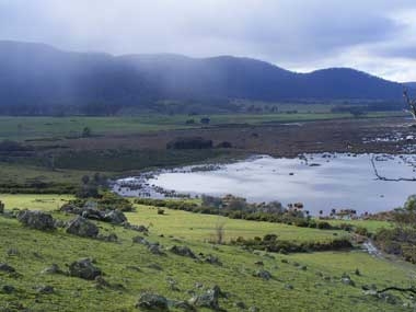
The Apsley Marshes Ramsar site covers the freshwater marshes at the mouth of the Apsley River, located on the east coast of Tasmania. The Apsley Marshes stores and filters flood waters from the Apsley River for slow release into the adjacent Moulting Lagoon Ramsar wetland. Both these wetlands are geologically significant as they were formed in a long-lived graben system, which is possibly related to the break up of Gondwanaland. The Apsley Marshes contain large areas of woody vegetation dominated by Swamp Paperbark. Saltmarsh communities occur in the southern section near Moulting Lagoon. Parts of the site are important for swan nesting, and it is an important feeding and breeding area for waterfowl which require a freshwater habitat. The marshes have a long history of human use, including use by Indigenous communities. The land is private freehold and used for grazing.
Apsley Marshes

Government evidence of impact of climate change:
-
Australian Government, Apsley Marshes Ramsar Site, Ecological Character Description
Low Long term (increased temperature) Climate change Storm surge flooding of Medium Long term (increased sea level vegetation (paperbark and and storms) saltmarsh).
The three aspects of climate that most directly affect wetland ecology are rainfall (both local and in the catchment); temperature and (to a lesser extent in temperate systems) relative humidity as these all fundamentally affect the critical component wetland hydrology and the water budget.
However this is a minor activity and not likely to pose any significant threat to the ecological character of the site. 5.5 Climate change Climate change predictions for Tasmania include an increase in temperature; a change in rainfall distribution (Grose et al. 2010) and an increase in sea level and storm surge flooding (Sharples 2006).
Low (increased temperature) Climate change Storm surge flooding of Medium (increased sea level vegetation (paperbark and and storms) saltmarsh).


