
The Glenelg Estuary and Discovery Bay Ramsar Site is situated in western Victoria. It covers approximately 22,289 hectares and comprises portions of the Lower Glenelg National Park, the Discovery Bay Coastal Park and the Nelson Streamside Reserve. The Glenelg River estuary is the longest in the bioregion, extending 75 kilometres. The Ramsar site comprises three broad systems that support different wetland types: freshwater wetlands, the Glenelg Estuary and the beach and dune system. The site contains several regionally (and internationally) rare wetland types: intact fen peatlands and a humid dune slack system.
The site:
supports the nationally vulnerable coastal saltmarsh ecological community and eight nationally / internationally listed threatened flora and fauna species.
provides habitat for 95 waterbird species including 24 species listed under international agreements: CAMBA (24), JAMBA (24), ROKAMBA (21), BONN (21). Beach nesting birds such as hooded plover (Thinornis rubricollis) and red-capped plover (Charadrius ruficapillus) are regularly recorded nesting on the dunes of the Discovery Bay Coastal Park.
supports 14 species of native fish which are diadromous, migrating between habitats for part of their lifecycle by providing food, spawning grounds and nurseries. It also acts as a migration path on which diadromous fishes of the region depend.
provides habitat for obligate aquatic species in the permanent wetlands of the Long Swamp complex and Bridgewater Lakes when the surrounding landscape is dry and during drought conditions.
supports > 1% of the population of the wetland dependent invertebrate species the Ancient greenling (Hemiphlebia mirabilis) in the Baumea sedgelands.
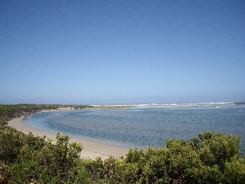
The area is popular for recreational and tourism activities, including sightseeing, walking, camping, and recreational fishing. Importantly, the Gunditjmara Indigenous people have a living association with the Ramsar site, which has great cultural significance for them, as it is part of their Koonang (sea) and Bocara Woorrowarook (river forest) country. The ecological character of the site is defined by 10 critical components, processes and services:
Components: Hydrology, Vegetation type and extent, Fish diversity and abundance, Waterbird diversity and abundance. Process: Stratification. Services: Special features (dune slacks), Supports a diversity of wetland types, Supports threatened species, Provides physical habitat for waterbirds, Ecological connectivity
Glenelg
* About the images

Government evidence of impact of climate change:
Close all
-
Australian Government and Victorian Government Department of Environment Land, Water and Planning, Glenelg Estuary and Discovery Bay Ramsar Site, Ecological Character Description
Gunditjmara; other people and climate change have impacted on the profile and ecology of the Bocara Estuary and Koonang Gunditj.
This risk posed by fires is likely to increase under climate change; as fires are expected to be more frequent and intense and fire seasons expected to start earlier and end later.
In addition; pollution can affect the aesthetic and recreational values associated with the beaches. 5.8 Climate change Climate change has the potential to affect CPS by changes in temperature; rainfall; evaporation; sea levels and ocean pH.
Recent climate change modelling for Australia has resulted in projections for a number of key variables that are important to the ecological character of the Ramsar site (Table 22).
The potential effects of climate change on Victorian marine environments; estuaries and wetlands are well studied (e.g. (EPA Victoria 2011;DSE 2013; Klemke and Arundle 2013) and are summarised in the following sections.
Table 22 Climate change projection summaries for the southern slopes Victoria west sub cluster (Grose et al. 2015).
Predicted change (relative to 1986 2005) Climate variable Confidence in predictions 0.4 to 1. 1.1 to 4.
The freshwater systems of the Ramsar site are vulnerable to prolonged decrease in inflows from surface and groundwater sources that are likely under climate change Decreased rainfall could also lead to increased salinity in wetlands and the estuary.
The vulnerability of Victorian marine and estuarine fish species to changed temperature under climate change was considered to be moderate (Hirst and Hamer 2013) and seagrass and soft sediment habitats to be variable (Morris 2013).
Invasive species; fire and recreational impacts are all likely to cause changes to vegetation type and extent.
Altered fire regimes may be one such factor; with fires likely to reduce competition.
A number of in lake threats were noted as possible contributors to the low biological scores; including boating and water sports; as well as surrounding landuse threats such as livestock grazing (EPA Victoria 2010). 5.5 Natural systems modifications 5.5.1 Fire and fire suppression Wildfire has the potential to affect CPS through impacts on vegetation type and extent; and water quality (e.g. increased sediment; turbidity and pollutant load); and poses a risk to threatened species and communities.
These plans recognise that days of extreme fire danger occur during summer in the Lower Glenelg area in most years and that fires may threaten life; property and natural values.
However; large; intense fires pose a risk to ecosystem values by affecting vegetation diversity; type and extent and may result in vegetation communities are overly dominated by fire tolerant species.
Key factors that are considered include the presence of species that require fire (e.g. for recruitment) and the frequency of fire that can be tolerated by the species that make up a vegetation communities in the area.
Drought and water resource use are likely to continue to impact on the hydrology of the site.
Flood depths may increase by over 50 centimetres near the outlets under the closed conditions.
Changes in reproductive timing; time to maturity and range extensions for northern species; were all considered to be likely outcomes from increased temperatures. 5.8.4 Storms and flooding An increase in extreme weather events such as storms could see destabilisation of dune vegetation leading to blowouts.