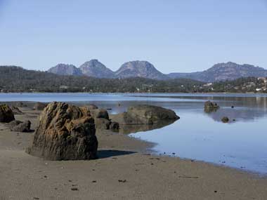
Moulting Lagoon is situated on the central east coast of Tasmania, between the townships of Swansea and Bicheno and approximately 6 km north-west of the township of Coles Bay. The lagoon is a large estuary at the mouths of the Swan and Apsley Rivers. The estuary lies at the head of Great Oyster Bay where the Freycinet Peninsula extends offshore to the south. The lagoon formed with the partial closure of the mouths of the Swan and Apsley Rivers, due to the creation of a bayhead spit and associated dunefield between 10 000 and 6 000 years ago. The lagoon contains areas of both shallow and deep water and is surrounded by periodically exposed mudflats and saltmarsh. The plant communities around Moulting Lagoon reflect the wide diversity of terrain and consequent soil drainage patterns. Aquatic vegetation in the estuary is largely composed of seagrasses. Succulent saline herbland and saline sedgeland and rushland, both saltmarsh communities, surround the lagoon. Vegetation in the shallower areas, mainly Beaded Grasswort and Sea Rush, provides an important nesting, roosting and feeding habitat for the numerous resident waterfowl. The Ramsar site is an important breeding area for Black Swan and an important staging area for all the other species of waterfowl in Tasmania, with particularly large summer concentrations of Australian Shelduck and Chestnut Teal. It also supports the largest known Tasmanian flocks of Greenshank. Moulting Lagoon is part of the Moulting Lagoon Game Reserve. The area historically was used for the harvest of waterfowl and their eggs by Indigenous people who lived around the lagoon. Current use of the Ramsar site includes recreational activities such as fishing and hunting, and commercial activities such as aquaculture and tourism.
Moulting Lagoon

Government evidence of impact of climate change:
-
Australian Government, Moulting Lagoon Ramsar Site, Ecological Character Description
The most significant threats to Moulting Lagoon emerge from immediate human use and from climate change.
Both these observations are consistent with climate change.
However; changes in Moulting Lagoon may also be attributable to other reasons; including changes in the catchment; land use and climate change.
Some of these factors are related; for example; to climate change a decline in incidence and magnitude of rainfall events (and thus flushing events); accompanied by an increase in air temperature.
CSIRO (2009) provide predictions of change under future wet and dry extremes of climate (2030) but state that whilst Moulting Lagoon would have been impacted by the recent climatic conditions; under future climate scenarios it is not likely to be impacted.
Sea level rise associated with climate change poses a potential threat to the ecological character of the Ramsar site.
Climate change has the potential to exacerbate the impacts of upstream water use through increased temperature and evaporation.
Human activity can also be a forcing function for example water pollutants; land use changes; climate change.
Climate changes may also increase the frequency or severity of storms and wave action.
Figure 30 Vehicle track damage and regeneration. 6.6 Fire Wildfire and control burns have the potential to impact on the site through increased nutrient and sediments loads; and fragmentation through direct loss of habitat.
Short term effects include; for example; lowering the salinity in the lagoon and increasing suspended sediment following a flash flood in the Apsley River.
Typical forcing functions include parameters such as changes in air and water temperature; salinity; solar radiation; peak and low fresh water flows; increased variability of hydrological conditions; storms; relative sea Ecosystem Components Ecosystem Processes Ecosystem services Evapotranspiration Flocculation Flood tide Flushing Fluvial geomorphology Forcing functions


