Why are Ramsar wetlands internationally protected?
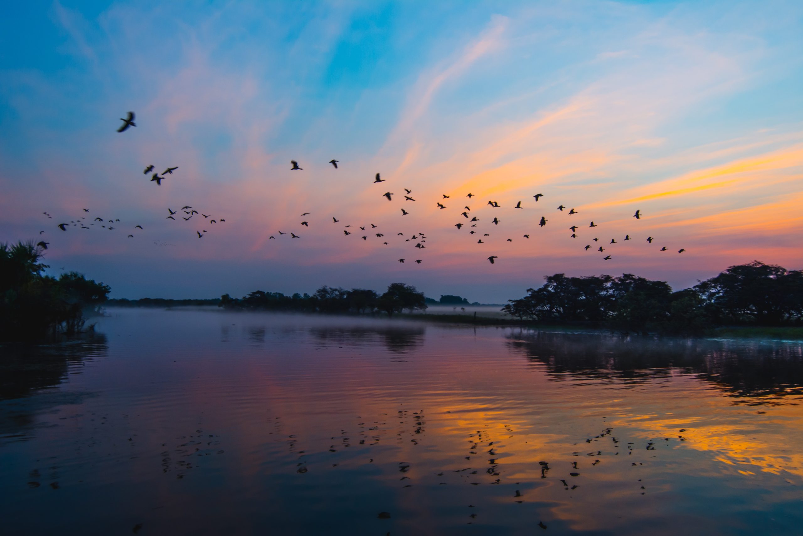
Wetlands are among the most diverse and productive ecosystems on the planet. Home to frogs, fish, mammals and far-flying birds, wetlands provide important roosting, nesting and feeding habitat as well as refuge during extreme weather.
Signed in Ramsar, Iran in 1971, the Ramsar Convention on Wetlands is a global treaty established by UNESCO to halt the worldwide loss of wetlands.
Climate threats to Australia's Ramsar wetlands
Australia currently has 66 Wetlands of International Importance listed under the Ramsar Convention. In our research, we reviewed 53 Australian Ramsar wetlands, 52 of which are likely to be impacted by climate change.
- Apsley Marshes
- Ashmore Reef Commonwealth Marine Reserve
- Banrock Station Wetland Complex
- Barmah Forest
- Blue Lake
- Cobourg Peninsula
- Coongie Lakes
- Coral Sea Reserves (Coringa- Herald and Lihou Reefs and Cays)
- Corner Inlet
- East Coast Cape Barren Island Lagoons
- Edithvale-Seaford Wetland
- Eighty-mile Beach
- Elizabeth and Middleton Reefs Marine National Nature Reserve
- Fivebough and Tuckerbil Wetlands
- Flood Plain Lower Ringarooma River
- Forrestdale and Thomsons Lakes
- Ginini Flats Wetland Complex
- Gippsland Lakes
- Glenelg Estuary and Discovery Bay Wetlands
- Gunbower Forest
- Hattah-Kulkyne Lakes
- Hosnies Spring
- Interlaken (Lake Crescent)
- Jocks Lagoon
- Kakadu National Park
- Kerang Wetlands
- Kooragang
- Lake Albacutya
- Lake Gore
- Lake Pinaroo (Fort Grey Basin)
- Lake Warden System
- Lakes Argyle and Kununurra
- Lavinia
- Little Llangothlin Nature Reserve
- Little Waterhouse Lake
- Logan Lagoon
- Macquarie Marshes
- Moulting Lagoon
- Muir – Byenup System
- Myall Lakes
- Narran Lake Nature Reserve
- NSW Central Murray Forests
- Ord River Floodplain
- Paroo River Wetlands
- Peel-Yalgorup System
- Pitt Water-Orielton Lagoon
- Pulu Keeling National Park
- Roebuck Bay
- Shoalwater and Corio Bays Area
- The Dales
- Towra Point Nature Reserve
- Western District Lakes
- Western Port
Climate risks to Lake Albacutya Ramsar site
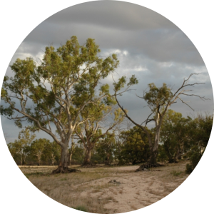
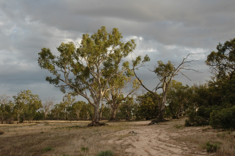
Around 400 kilometres northwest of Melbourne, Lake Albacutya is a Ramsar listed wetland of international importance that has been dry for many years.
A large, rare, seasonal, intermittent freshwater lake, the wetland only fills after significant rain. The last time water flowed into the lake from the Wimmera River was in the mid-1990’s and it hasn’t completely filled since the early 1970’s.
Lake Albacutya alternates between wet and dry phases and is home to climax communities in both states. When dry, the lake is home to grasslands and terrestrial wildlife. When the lake has water, it supports enormous breeding waterbird populations and a developing aquatic community.
Home to nationally vulnerable Regent Parrots, rare Freckled ducks (Sictonetta naevosa), and Freshwater Catfish (Tandanus tandanus), the lake also features in Jakelbalek stories as Nalbagadja, the place where Purra the kangaroo fed on bitter quandongs while fleeing from Wembulin the spider.
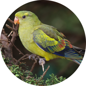
Regent parrot (Polytelis anthopeplus).
Vulnerable. Photograph: JJ Harrison, CC BY-SA-3.0.
However, for years the lake’s ecology has been impacted by river regulation, and climate change poses a significant threat to its ecological character.1
-
Read more evidence on climate risk to the Lake Albacutya
According to the Ecological Character Description for Lake Albacutya:
- Climate change is a key threat to the ecological character of Lake Albacutya. Potential impacts include reduced frequency, duration and extent of flooding; interference with migration, reproduction, regeneration and recruitment processes; reduced habitat availability and quality for waterbirds; and declining eucalypt woodland health. The significance of the threat is classified as “high”, the likelihood of impacts is “medium” and the timing of impacts is “short to long term”.2
- The vast majority of various climate change prediction models predict a significant decrease in run-off. This poses a severe threat to the hydrological regime of Lake Albacutya which is already impacted by river regulation.3
- Climate change is identified as a potential threat to the representativeness of near-natural wetland and waterbird habitat embodied by Lake Albacutya, and which contribute directly to the Ramsar values of Lake Albacutya.4
- Changes in the fire regime at Lake Albacutya, including frequency, intensity or season, can reduce the abundance and diversity of native vegetation resulting in a loss of fauna habitat.
-
Endnotes
1 Ecological Character Description, Lake Albacutya Ramsar Wetland (2010), 28, 32, 54, 132-134.
2 Ecological Character Description, Lake Albacutya Ramsar Wetland (2010), 28, 32, 54, 132-134.
3 Ecological Character Description, Lake Albacutya Ramsar Wetland (2010), 27, 130.
4 Ecological Character Description, Lake Albacutya Ramsar Wetland (2010), 28, 32, 54, 98, 132-134.
Climate risks and the Kerang Wetlands Ramsar Site
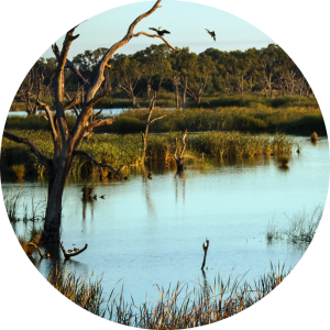
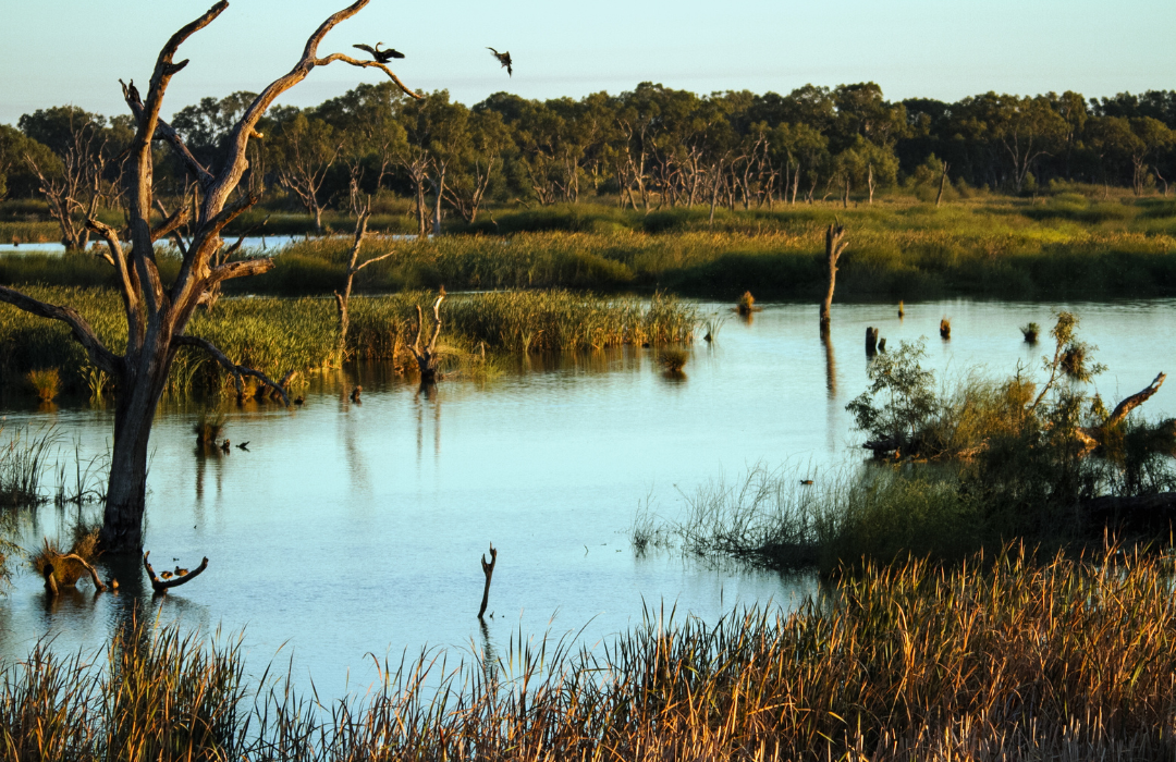
Middle Reedy lake, Kerang Wetlands Ramsar Site.
Photograph: Gypsy Denise. CC BY-SA 4.0.
Another example of Ramsar wetlands at serious risk from climate change is Kerang Wetlands.
Located on the lower reaches of the Avoca and Loddon Rivers and the Pyramid Creek near the town of Kerang, this Ramsar wetland’s 23 lakes, marshes and swamps are a haven for birdlife. A diverse wetland system, some of Kerangs’ wetlands vary in their depth, salinity and size. Some fill only intermittently, while others are home to an abundance of waterbirds, reptiles, fish and plant species year round.
However the evidence shows Kerang Wetlands are at risk from climate change, with more frequent extended droughts and less frequent floods likely to harm all inhabitants of this Ramsar Site.5
-
Read more of evidence on climate risks to Kerang Wetlands Ramsar Site
According to the Ecological Character Description for Kerang Wetlands, climate change is a likely medium to longterm threat to the Ramsar site. Its potential impacts include impacts to significant wetland types, hydrology, flora and fauna and waterbird breeding habitat.6
- Climate change poses a threat to the drainage wetlands as higher temperatures and dryer conditions would lead to increases in evaporation rates, which affect salinity and groundwater levels.
- Significant climatic changes have the potential to change the character of the Ramsar site, specifically its hydrology and salinity (which has repercussions for vegetation and fauna communities and habitat).
- Climate change is expected to impact on all aspects of the water cycle of the region; reduced rainfall and hotter temperatures producing less water for rivers and storages, drier soils resulting in less run-off to waterways, and more evaporation occurring from rivers, channels and storages. With climate change there are likely to be more frequent and extended droughts, with longer dry spells and less frequent floods. The impact of this is that there will be less water for rivers and wetlands, irrigation use and a significant reduction in environmental flows.
- Extended drought will reduce the availability of waterbird habitat (through vegetation loss and reduced amounts of open water). Reduction of water volumes and flood frequency may also lead to stagnation of wetlands and changes to nutrient cycling.
- Climate change is a significant threat as it has the potential to cause degradation and lead to the reduction or loss of the critical services and benefits of the Ramsar site.7
-
Endnotes
5 Ecological Character Description, Kerang Wetlands Ramsar Site (May 2011), 81-82.
6 Ecological Character Description, Kerang Wetlands Ramsar Site (May 2011), 81-82.
7 Ecological Character Description, Kerang Wetlands Ramsar Site (May 2011), 81-82.
Climate risks and Ginni Flats Wetland Complex Ramsar Site
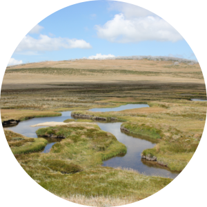
The Ginni Flats Wetland Complex is another example of a Ramsar Wetland at grave risk from climate breakdown.
The Ginni Flats Wetland Complex is an internationally significant Ramsar Site inside Namadgi National Park in the Australian Capital Territory.
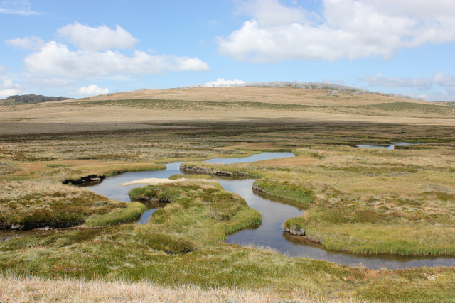
The largest intact Sphagnum bog and fen community in the Australian Alps, the Ramsar site lies at an altitude of between 1,500 and 1,600 metres above sea level. It is a composite of subalpine sphagnum bogs and associated wet heath and wet grassland habitats occupying a series of interconnected wetlands.
They are also home to tiny Northern Corroboree Frogs (Pseudophryne pengilleyi), which are critically endangered and are only found at altitudes above 1000 metres above sea level. They are a species in rapid decline, due to fungal infection, invasive species and climate events like fire and drought, and climate change.
Situated at the northern extreme of the climatic range for sphagnum bog wetlands in the Australian Alps, the Ginni Flats wetlands are already at the limit of climatic tolerance, and climate change is their greatest threat.8
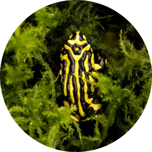
Northern Corroboree Frog
(Pseudophryne pengilleyi). Endangered.
-
Read more evidence on climate risks to the Ginini Flats Wetland Complex
According to the Ecological Character Description for Ginini Flats Wetland Complex:9
- Climate change is the greatest threat to this Ramsar Site, as well as the myriad impacts and potential positive feedback mechanisms that can occur.
- Climate change has the potential to alter all critical components and processes (for example hydrology, peat formation, vegetation, habitat availability, water quality, groundwater recharge), and thus the services that characterise the ecological character of the wetland.
- Fire results in changes to vegetation, peat formation, hydrology and water quality. Many impacts are medium term (for example decades) and have the potential to significantly affect the ecological character of the wetland.
- The risk assessment identified the greatest risks to the Ramsar site, with the most severe consequences associated with climate change.10
-
Endnotes
8 Ecological Character Description, Ginini Flats Wetland Complex Ramsar Site (December 2010), 45.
9 Ecological Character Description, Ginini Flats Wetland Complex Ramsar Site (December 2010), 45.
10 Ecological Character Description, Ginini Flats Wetland Complex Ramsar Site (December 2010), 51.

